What Has Changed Since Previous Email?
- No new changes outside of potential chance of heavy rainfall this week.
Overview:
- A wet week is shaping up, starting today with areas from the Houston metro to the coast seeing widespread rainfall of 1 to 2 inches with several hours of rain – ending this evening. Isolated areas could see 3 inches, which could result in some street flooding.
- Cold tonight, and into Tuesday morning with wind chill temperatures falling into the lower to mid-30s due to temperatures around 40 and northerly winds of 15 to 20 mph.
- Rain chances will increase again on Wednesday afternoon. Locally heavy rainfall is likely on Thursday and Thursday night as a surface low forms near the coast and a reinforcing cold front approaches from the northwest. High moisture levels and an approaching upper-level disturbance will set the stage for another round of widespread rain across coastal and southeast areas. Locally 3 inches is possible. A little higher chance for some street flooding with this event due to wet grounds from today’s rainfall.
- Monitoring tide levels with the moderate offshore flow early this week, and then a surface low tracking northeast along the coast Wed/Thu. It does not look like we will reach critical thresholds this week, with low tides remaining above -1.0 and high tides remaining below 3.5 feet relative to MLLW.
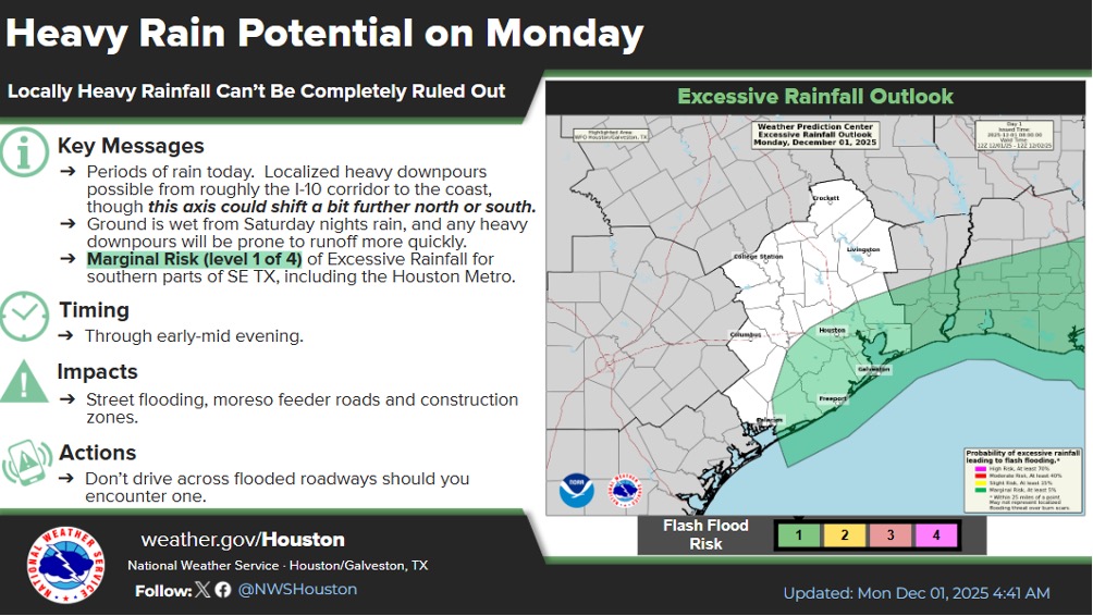
Weather Synopsis:
Periods of cold rain, and some embedded storms, will expand across the region today and persist into early mid evening. The axis where the heavier rain sets up will be situated along an upper-level wind boundary which should generally lie between the Interstate 10 corridor and the coast…though some guidance suggests it could fluctuate 15-25 miles north or south. Regenerating/training cells are expected. On average look for 1-2″ rain across southern parts of SE Tx with localized 2-4″ totals a possibility. Many locations saw 1-4″ rains Saturday night, so the ground is wet. Any localized, heavier downpours will be prone to runoff more quickly. If/where this occurs, minor street flooding will be possible – especially feeder roads, construction zones and other spots with poor drainage. Hazardous marine conditions are anticipated with elevated winds/seas. Heavy rain will reduce visibility at times.
Urban Flash Flood Messaging
Localized heavy rainfall is forecast for portions of Southeast Texas, including highly urbanized areas like the Houston metropolitan area. Based on forecast conditions, NWS Houston will be utilizing the following urban flash flood messaging for this event:
Street Flooding
- Drive with caution. Cars may flood in low-lying areas. Ponding on roadways may increase risk of hydroplaning.
- Pay attention to the weather. Monitor the NWS, your local media, HCFCD and other official weather information sources.
- Rain may move repeatedly across the same area, causing a rise on creeks and bayous. However, creeks and bayous are not likely to exceed their banks.

